|
|
| |||||||||||||||||||||||||||||||||
|
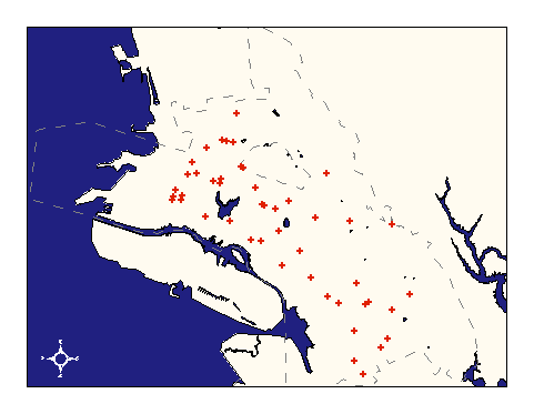
City of Oakland data set: Shelter Sites |
|
 |
Who maintains the data for this layer: Jeff Thompson, OES Data Maintainer Phone: (510) 238-3938 Who converted the data into a GIS format: Julia Howlett GIS Technician Phone: unlisted Size of GIS layer (KB): 116 Size of export file (KB): 60 Where is the layer stored (on the k-drive): k:\gisdata\other\shelter.e00 This GIS layer was last updated on: 1/20/97 This metadata was last updated on: 3/11/97 This layer's FGDC category description is: Other (Non-FGDC) |
|
Data Set Description: This layer contains the locations of emergency shelters. Often, shelter locations are existing community buildings or areas such as churches, schools, or parks. Non-standard Attributes in table:
Data Source History: The list of shelter sites with addresses and various attributes was collected from the American Red Cross, the City of Oakland's Office of Emergency Services and the City of Oakland Parks and Recreation by Linda Wong (OES). The American Red Cross approved the primary and secondary sites in December 1996 after reviewing each site using criteria such as earthquake prepared structures, facility size and amentities. Quality Check: This layer was created by geocoding site addresses against the Streets layer to produce points. The geocoding process locates the street for each entry and then interpolates the building number from an address range between street intersections. Because of this process, points showing site locations are approximate. Security restrictions: No security restrictions on this layer Update Frequency: Updates occur on a yearly basis or as decided by OES staff. Update process:
Addresses of new shelter sites will be geocoded and appended to the existing cover age by an OCIS GIS resource. |