|
|
| |||||||||||||||||||||||||||||||||
|
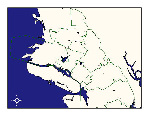
City of Oakland data set: City Council Districts |
|
 |
Who maintains the data for this layer: Monica Lamboy, CMO Data Maintainer Phone: (510) 238-3674 Who converted the data into a GIS format: Jake Schweitzer GIS Technician Phone: unlisted Size of GIS layer (KB): 115 Size of export file (KB): 187 Where is the layer stored (on the k-drive): k:\gisdata\gover\council.e00 This GIS layer was last updated on: 2/28/97 This metadata was last updated on: 3/20/97 This layer's FGDC category description is: Governmental Units |
|
Data Set Description: City Council Districts delineate the jurisdictional boundaries of the city council members. Non-standard Attributes in table:
Data Source History: The data was received from ESRI as an Arc/Info coverage in UTM projection, NAD27. Jonathan Lowe, Local Knowledge Consulting, converted the layer into Cal Stateplane, NAD83, units feet, using Arc/Info's projection utility and two custom AML's called "utm2spc.aml" and "nad2783.aml." Upon the adoption of the "streets" coverage and the digital orthophoto as Oakland's standard for coordinate accuracy, Jonathan corrected the council coverage using the arc/info "adjust" command with parameters based upon the node-to-node links established during the tiger-roads conflation process. Jake Schweitzer, In Situ Mapping, made further manual adjustments to the layer to match the improvements in accuracy of the streets and city limits layers. Quality Check: No quality control procedures have yet been performed on this layer outside of OCIS. Security restrictions: No security restrictions. Update Frequency: No updates scheduled Update process:
Update process is not yet defined. |