|
|
| |||||||||||||||||||||||||||||||||
|
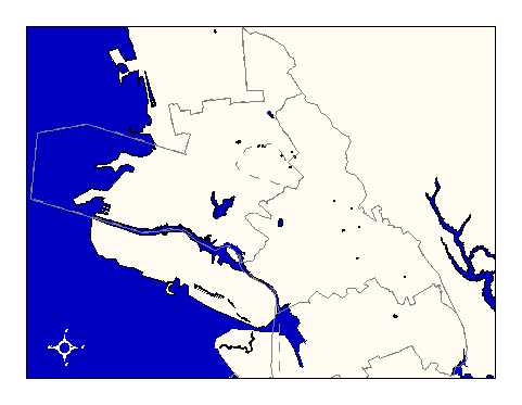
City of Oakland data set: Fire Battalions |
|
 |
Who maintains the data for this layer: Capt. Mike Kelly, OFD Data Maintainer Phone: (510) 238-4038 Who converted the data into a GIS format: Jonathan Lowe, Julia Howlett GIS Technician Phone: unlisted Size of GIS layer (KB): 164 Size of export file (KB): 100 Where is the layer stored (on the k-drive): k:\gisdata\gover\batt.e00 This GIS layer was last updated on: 2/27/96 This metadata was last updated on: 3/20/97 This layer's FGDC category description is: Governmental Units |
|
Data Set Description: Fire battalions divide the City into sub-areas that are a basis for resource assignment in emergencies requiring a larger response than one engine company or one still district. Non-standard Attributes in table:
Data Source History: Capt. Mike Kelly, OFD, delivered a AAA paper map (1980, scale 1" = 2640') with battalion boundaries highlighted with a flourescent hi-lighter marker. The battalion boundaries followed street centerlines and/or city limit lines. Jonathan Lowe (LKC) scanned and registered the paper map to the existing center of pavement GIS layer using ArcInfo's register and rectify commands. Jonathan then digitized the battalion lines using the heads-up technique of on-screen digitizing. Quality Check: Julia Howlett, JRH Consulting, corrected the accuracy of the battalion lines when the overall accuracy levels of the Oakland GIS layers improved. Security restrictions: No security restrictions. Update Frequency: No updates scheduled. Update process:
Update process is not yet defined |